
Feb 15, 2026
Feb 15, 2026
Turning pages of the Earth's history is very fascinating. It becomes more interesting when it comes to our ancestors-the hunter, gatherer communities of stone ages. How they lived, how they coped up with the natural hazards can only be conjectured by their remains found in the form of stone implements and the like. Sometimes the records are more continuous and we strike a rich haul of Paleolithic to Neolithic communities in one locality. What intrigues is that in the same valley we get an evidence of Paleolithic man in one part and Neolithic man in the other. One wonders why this shift from one area to another in the same valley!
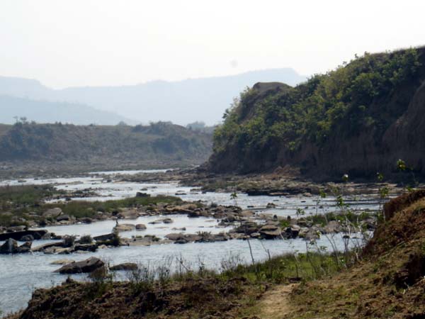
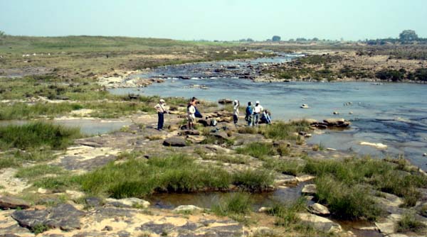
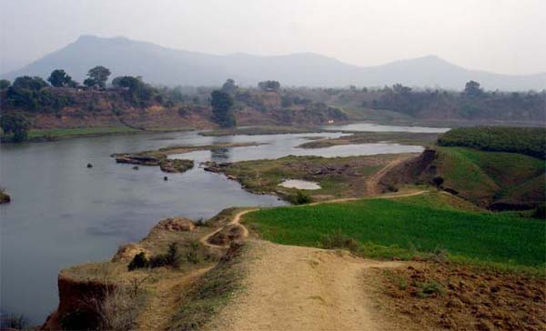
Belan River, a tributary of Ganges system on the southern margin of the Ganga plains draining territories of Madhya Pradesh and Uttar Pradesh is famous for archeological sites. The archeological finds from the Belan valley have revealed many interesting facts like how the earlier, hunter and gatherer man became a cultivator. Belan River valley has the credit of being the first archeological site with evidence of first cultivation of rice. In addition there are several evidences of existence of Upper Paleolithic to Neolithic cultures in the area. It appears that the area was colonized by the ancestors and they no only tilled the fields but also domesticated animals for their use. Such sites fascinate the geologists-like forensic scientists they gather clues about the intensity of monsoons, types of rivers and their habits of shifting courses etc.
The archeological sites of Belan valley show evidences of climatic instability after the Last Glacial Maximum (LGM) that is around 18,000 years ago. When everything is frozen under the ice, there is hardly any water in the rivers. Howling winds carry lots of dust in their wake as there is no moisture to hold the dust. Thus wind-born sediments get deposited in the valleys. Once the temperatures rise and the ice begins to melt river-born sediments keep piling. Belan valley has the interaction of wind born and river born sediments say M.R. Gibling of Dalhousie University, Nova Scotia, Canada, Rajiv Sinha and N.G. Roy of IIT, Kanpur, S.K. Tandon of University of Delhi and M. Jain of Ris' National Laboratory, Radiation Research Department, Roskilde, Denmark in Quaternary Science Reviews, 27 (2008).
We have been reading about great civilizations from childhood. Most of us carry an impression that such civilizations thrived along the major river valleys. It is not so. On the contrary, they are found in the higher reaches of the river systems. May be our intelligent ancestors knew the pulse of the rivers better and avoided flood prone areas! That could be one reason that the first rice growing habitation developed on the southern fringe of Ganga plains under the shadow of scarps of Vindhya mountain ranges in the Belan valley. It is an interesting coincidence that the earliest agricultural community of Indian subcontinent came up on the banks of the Bolan, a similar sounding river on the Baluchistan rim of the Indus valley.
https://www.boloji.com/articlephotos/Bygone Communities Faced Ire of the River.jpg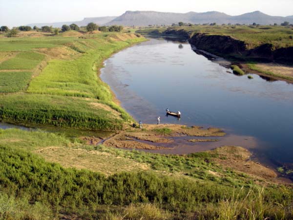
Mountains of the Vindhya group, the old guards with rocks 2500 to 542 million years old have been carved by the Belan river to form a low relief valley about 80 km southeast of Allahabad. Running parallel to the plateau topped Kaimur Hills; the river joins the Tons River south of Allahabad. It is a rocky terrain and the river has been able to deposit a 22 meter thick alluvium resting on the bedrock on both banks. Average, present day rainfall is 800 to 1000 mm, which increases to 1000 to 1400 mm on the Kaimur hills. It is the southwest Indian Monsoon that caters to the rainfall in the area. The river valley is carved in such a manner that on the north there is a gently undulating bed rock plateau and on the south, there is the Kaimur scarp with an elevation of 473 m.
The evidences available from Belan valley and elsewhere from the sites across southern Asia and also from the offshore regions indicated that the monsoon intensified after the LGM of Marine Isotope Stage 2. Marine Isotope Stages as per the Wikipedia are alternating warm and cool periods of in the Earth's past climates, deduced from oxygen isotope data reflecting temperature curves derived from data from deep sea drill cores. Here it may be mentioned that famous paleoclimatologist Sir Nicholas Shackleton was the first to find out that the changes in the oxygen isotopes of sea water from O18 to O16 were not merely due to changes in the temperature, but were due to changes in the overall seawater chemistry throughout the globe due to build up of ice on the landmasses. He postulated that when there is more ice on the surface of the earth, the sea water gets isotopically heavier, compared to periods when there are no ice sheets on the continents. At present we are living in Marine Isotope Stage 1.
The Indian records suggest, according to Gibling et al that the monsoon in India peaked at 8-9000 years Before Present (BP). Gibling and his team postulate that it peaked around 6000 years BP or later. Researchers in Thar Desert have found evidences of this peaking at 7200 to 6000 years BP. Other evidences from the nearby Sanai Tal about 150 km from Belan archeological sites indicates that the monsoon peaked around 6700 years BP. Around this time the lake area had reached its maximum, which is possible only by increased precipitation.
Gibling et al state that the Belan River the 20 m thick alluvium was deposited by a river which was meandering through the area. This alluvium is the storehouse of the Middle Paleolithic artifacts and has been dated between 85711 to 7278 kyr BP. It naturally implies that during these 78,000 years there was a sustained river activity in the area. In other words, there was plenty of food available around. There was no death of rainfall as a result the community thrived and prospered on the banks of the river. For about 10000 years between 21-31 kyr BP there was less rainfall, as evidenced by the reduced alluvium thickness. The dates obtained by these researchers from various methods show a climatic uncertainty between 14-7 kyr BP. During this period there are evidences of intensified monsoon as well as wind born sediments reflect a local wind action near the Kaimur Scarp.
The Old Stone Age community on the banks of Belan as it matured to Middle Stone Age faced the constraint of sudden change in the course of the river. As the river abandoned its course and shifted to a newer reinvigorated course, later the farming and animal herding Neolithic community developed along the new course.
As long as the human communities had not turned agrarian they settled in areas which had availability of food in plenty. Since it was a hunter-gatherer type of community, they were constantly on the move. It was only after the concepts of cultivation and cattle rearing developed they began to settle. Many of the settlements faced the wrath of the rivers and were washed out. Many times the rivers changed course all of a sudden, the community surviving on its bank vanished, probably perished due to hunger!
The wide swing of the Kosi River to capture a course that it followed in 1731 is one of the recent examples about how a river can elude and makes one realize that taking the rivers for granted is not prudent. The rivers in the alluvial terrains specially, flow through fertile valleys, which are now one of the most densely populated areas. The rivers draining from the Himalayas to such valleys need to be observed more closely and constantly to avoid tragedies like the one that hit Bihar in the past few days.
Instead of waiting for a bund to breach or the river overflow its banks it is high time that the planners and administrators develop mitigation measures much before the disaster strikes.
19-Oct-2008
More by : V. K. Joshi (Bijji)