Jul 27, 2026
Jul 27, 2026
The Himalayas and the landslides are synonyms. Had the Indian plate not collided with the Asian plate some 50 million years ago, the Himalayas would not have been there. It was only because of that collision that a new mountain chain was formed and the geography of the region was written once again. It is common sense that water flows down the slope and after the rise of the Himalayas, steep slopes had come up. Naturally they became targets of water flowing on their surfaces. The agencies of erosion like water, air and temperature all became hyperactive and thus began the process of mass wasting.
But there was a relief, once the slopes were stabilized and an angle of repose was set, the landslides stopped as long as that angle of repose was not disturbed and or excessive rains did not disturb the tranquility. Gradually, over a period of time, according to altitude vegetation came up on the mountain slopes. The roots of the trees like pine, cedar and oak held the slopes intact. Yet, depending upon the compactness of the slope forming material and its solubility in water landslides kept occurring.
The Himalayas are not live, yet they have a great quality of issuing warnings to the mankind. Alas, man thinks he is above the nature, hence ignores the warnings. If we take a look at some of the past landslides that have adversely affected life, the picture becomes absolutely clear.
Mr. P. Baron, the British businessman, accidentally discovered Nainital in 1840 and by 1841, the first house was constructed there, named the ‘Pilgrim’s Cottage.’ Thus began the inhabitation of Nainital. Mr. Atkinson wrote a detailed Gazeteer of Kumaon and he mentions of a landslide in Nainital in 1866. The slide affected the portion of Nainital where the present day high court and other residential colonies are situated. Nainital, mind you is made of limestone, which is water soluble. Thus over the years, the slide material reconsolidated due to water action. The British too were not that wise till then and except making few drains did not think much of the slide. They constructed all the buildings on this slope made of reconsolidated material.
It was the month of September when a heavy downpour struck Nainital between 16 and 19 September, 1880. Atkinson, in his Gazetteer of Kumaon, records 25 to 30 inches of rain in 40 hours. Water had choked all the drains and had penetrated the loose soluble slope forming material. As a result the whole mountain mass tumbled down and covered quite a bit of the northern part of the lake. This part is now known as the Flats, a popular haunt for the tourists. The population of Nainital was much less those days, hence only 154 people lost their lives. Imagine what will happen today, if, god forbid the scene is repeated!
The British took precautions thereafter and developed a systematic network of pucca lined storm water drains on the slopes of all the hills surrounding Nainital. Those drains have, till now saved Nainital from complete destruction.
The British kept exploring the Himalayas and in 1893 came the news of a spur of Kunwari parvat slipping down across a narrow neck of Birehi Ganga 22 km off Belakuchi on Chamoli—Badrinath road. This slip caused blocking of the stream and a huge lake was formed at Gohna. In July 1894 a British Geologist examined it and postulated that the lake would burst on 26th August! His warning was taken seriously and a telegraph line was immediately laid from Gohna to Haridwar to forewarn the inhabitants downstream in time. The lake did burst, but only partially. But the telegraph line came as a boon, only one family perished, because they had ignored the warnings and gone back to their house in Srinagar to collect more possessions.
The dam held on for the next 70 years but one fine morning it gave way all of a sudden A 300 feet deep water column escaped from the Gohna Tal. It caused devastation in its wake-wiped out Belakuchi village near the confluence of Birehi and Alaknanda. When such a giant column of water moves down the slope with a fury, it erodes through the toes of all the spurs that project into the River and leads to series of landslides all along. That is what Birehi and Alaknanda did that year. The losses were terrible.
But unfortunately, the memories of people are short and once again in 1978 sudden heavy rains in the upstream areas of Bhagirathi led to damming of the River near Dangla. A huge lake was formed in a manner similar to Gohna Tal. But unlike Gohna Tal, this lake could last for four days only. It wiped out Gangnani village completely and mauled Uttarkashi and Bhatwari severely. Naturally all along its valley down the slope, Bhagirathi played havoc that year.
But that was not the end innumerable major episodes of landslides have taken place in the past 35 years. The list is pretty long. Take for example, Uttarkashi, it was badly scared in 2003 and again in 2010 and again this year (2013).
It seems we are hell bent on challenging the nature and keep constructing in the paths of the rivers and on the fragile slopes. We have all the might of dynamite with us and we will keep on blasting the hills for making roads and tunnels. We need wood to make our houses, so we do not care for the forests that are the anchors of the hill slopes. The hacking of the forests of the Himalayas had started during the British regime and it continues unabated-partially scientifically and mostly on the sly.
People of Uttarakhand want roads for communication. They have every right to demand that. But the buses that ply on those roads or any other vehicular traffic generate vibrations which are equal to mini-earthquakes. Rain soaked Himalayan slopes, bereft of trees become more vulnerable to landslides specially, when they vibrate endlessly due to vehicular movement.
It is high time that the Government takes a stock of the landslides and the losses generated thereby, arranges for state of the art slope morphometric studies and gets landslide zonation maps prepared for the engineers and planners to plan more stable slopes. But all this would be meaningless unless massive afforestation is carried out.
Himalayas give us water, rains and are great sink for the Carbon Dioxide that we keep belching in the atmosphere. If the Himalayas are ruined because of our greed, the entire country would suffer at the hands of the nature.
Images:
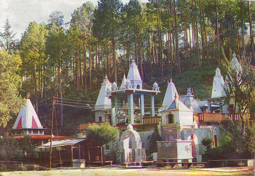
Trees hold the mountain slopes
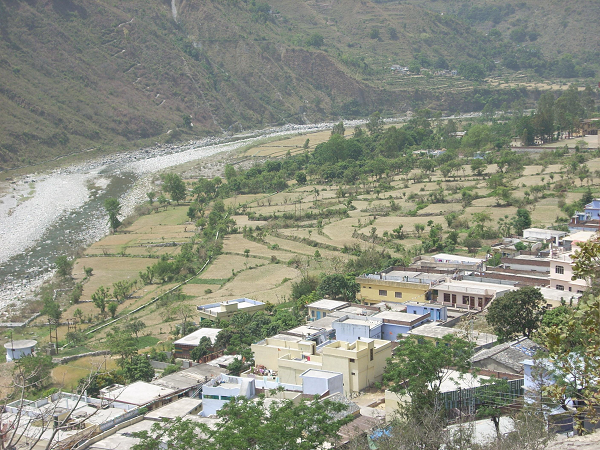
Rivers scour the toe of mountains, leading to landslides
(Images curtsey Prashant Joshi)
07-Oct-2013
More by : V. K. Joshi (Bijji)
|
|
Thank you Mohinigurav. I am glad that you found it useful! Yes if everyone develops a concern for the Mother Earth, am sure it will repay us with her riches, |
|
|
Very Informative .For sure will create eco-concious awareness among the people. Its the need of the hour to save our own existence on Planet Earth... Save Mother Earth.. |
