Jul 27, 2026
Jul 27, 2026
 Natural or anthropogenic phenomenon, that pose a threat to human lives and property are called as hazard. The nature is always at work. Therefore, a river keeps eroding, mountain slopes under given conditions move down to cause landslides, earth trembles causing earthquakes etc.
West Bengal lying on the east of the country has a peculiar disposition. It is a coastal state as well as a state with highland like Darjeeling and the state has the vast Ganga-Brahmaputra plains too. Like any other state, West Bengal too has its share of natural and man made hazards like cyclones, floods, droughts, landslides, subsidence, occasional earthquakes, pollution of surface and subsurface water etc.
It is therefore, clear that the state of west Bengal needs a disaster preparedness and mitigation plan. Sankar Kumar Nath and Kiran Kumar Singh Thingbaijam of Department of Geology and Geophysics and Debasis Roy of Department of Civil Engineering, IIT, Kharakpur published a detailed review of the situation in west Bengal and have suggested remedial measures in the April issue of the Current Science.
The natural environmental hazards which most commonly affect the life of the state include floods, cyclones and storm surges, droughts and land subsidence. Earthquakes and tsunamis are the hazards that affect the state once in a while. It is better to be informed rather than remain blissfully ignorant and get lashed by the nature's ire.
G.R. Brakenridge and his colleagues from Dartmouth Flood Observatory, Hanover, USA have compiled digital records of major deluges in various parts of the globe. As per that between 1985 and 2007 West Bengal has faced 23 major floods. Irony is that the rivers submerging vast tracts of habitation and agriculture lands have origins outside the state. Sankar and his colleagues state that 55.8% of the region is susceptible to floods. It means more than half the area of the state is prone to deluges.
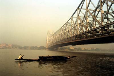
Kolkata, Hooghly, Howrah, Paraganas, Midnapore, Burdwan, Birbhum, Jalpaiguri, Cooch Behar, Malda, Murshidabad and Darjeeling areas seem to face the worst ever year. The recent trends of floods are more alarming because densely populated Kolkata gets marooned during monsoons. During September and October 2006 the deluge was so powerful in Kolkata that 2000 people had to be evacuated. In 2007 the flood scenario was so grim that 51 people lost their lives and 3.2 million people were affected by floods record Sankar and his co-researchers.
Reading about Kolkata raises questions that why the metros on the coasts are becoming prone to floods. Whether Mumbai or Kolkata, scenario remains pretty bad. One of the main reasons is the lack of proper drainage. Near coast the ground tends to become more flat, as such excess water does not flow smoothly. Drains constructed for the purpose are not able to cope up with the rain water because of lack of proper maintenance/remain choked by the city's garbage. Apartments and housing colonies have erupted on the natural path of excess rain water, flooding is but natural.
A strategic plan for flood hazard in urban areas therefore must include construction, restoration or improvement of drainage and removal of all human encroachment along the river banks. Since this is an on going process highest priority therefore should be given to search, rescue and evacuation process. Quick and correct damage assessment would enable speedy restoration and rehabilitation in terms of physical, economic and social aspects recommend Sankar et al.
The next worst natural hazard that hits W. Bengal almost every year is the cyclone. One of the worst cyclone hit Sagar Island killing 50,000 people and 1,00,000 cattles in March 1833. Again in October 1854 a 12 m high surge hit the coasts and water levels rose in Kolkata and neighborhood. Nearly 50,000 people perished in this cyclone. The cyclone of 1864 caused floods on 13 km on either side of Hooghly River killing 80,000 people. While the Independence struggle was on in 1942 15,000 people perished in W. Bengal due to cyclone. In the later years call it providence or improved communication systems that the number of deaths has become less though the loss of property has shown a rise. Main reason for this could be more and more people settling close to the sea!
A better preparedness can further reduce the losses says Sankar et al. Stable cyclone shelters on high grounds, fast communication systems and rapid distribution of information about impending cyclone to keep the society alert are important measures. Land use plans need a detailed look, because permitting permanent structures like hotels on cyclone prone shores are open invitations to tragedy.
As already stated a part of the state of W. Bengal is hilly tract of Darjeeling District. Landslides and mountain slopes are almost synonymous. In 1968, floods in the Darjeeling area destroyed vast areas of W. Bengal and neighboring state of Sikkim by unleashing about 20,000 landslides and killing thousands of people, report Sankar et al. These slides were caused by a heavy downpour ranging from 500-1000 mm in three days. Such incidents have a return period of 100 years claim the meteorologists. The impact of the rains was such that the Darjeeling-Sikkim road was breached at 92 places and the road transport was totally disrupted.
Though such heavy landslides are not a routine but a few landslides do affect the road communication each year and often lives are lost too. One of the root causes is the construction activity on the hill slopes. Material on the mountain slopes lies in an angle of repose and remains in a state of balance. If a construction activity, undercutting of mountain 'toe' by a swift river or an unusually high rainfall can trigger a downward motion of the material. Gravity aids to the phenomenon and the mountain slides, killing people and destroying property in its wake.
Landslide is one hazard that can be predicted in advance. But before doing so, detailed information is required. Using satellite data and Geographical Information System various thematic layers describing the geological characteristics, water conditions, material properties, topographical inclinations, seismic activities, prediction of soil behavior under load, etc. are considered for the thematic integration to achieve hazard zonation says Sankar et al. These zones categorize high, medium and low hazard zones and the municipal authorities can accordingly allow the construction activity suitable for the particular zone.
Alluvial terrains everywhere face droughts due to less than required rains and agricultural droughts due to lack of moisture in the soil. Bankura, Purulia and Bribhum districts of W. Bengal face droughts of these types frequently. Outlining the steps required for managing droughts Sarkar and his co-workers say drought management and planning involves water supply augmentation and conservation (e.g. rainwater harvesting techniques), expansion of irrigation facilities, effective dealing with drought, and public awareness and education. Transport and communication links are a must to ensure supply of food and other commodities during and just after a drought. Successful drought management requires community awareness on the mitigational strategies, insurance schemes for farmers, crop contingency plans, etc.
It is an irony that the management techniques outlined by the researchers are well known to the district authorities and plans are accordingly made. But it hurts to realize that actual relief to a drought hit farmer does not reach. What he gets is a pittance. The relief work needs stricter supervision by the people's representatives and the administration both.
Though, it experiences earthquakes at a relatively low frequency of seismic hazard zonation map, West Bengal by virtue of its geological disposition has areas falling in varying earthquake hazard zones. As per the map of Bureau of Indian Standards W. Bengal lies in seismic zones II-IV, corresponding to peak ground acceleration (PGA) of 0.1, 0.2, and 0.25 (1 g = 980Gal) respectively. Purulia in south west part of W. Bengal has is in the lowest hazard zone II While northern and southeastern parts of Kolkata metropolis lie in zone IV. In addition Darjeeling, North and South Dinajpur., parts of Jalpiguri and Coochbehar, North and South Paganas and Malda also fall under zone IZ. Eastern parts of Jalpaiguri and Coochbehar fall in zone V inform Sankar et al. A considerable part of W. Bengal falls in the zone III. For example districts of Kolkata, Murshidabad, Birbhum, Bardhaman, Hooghly, Howrah, Nadia, Bankura and East and West Midnapur fall under zone III.
The Himalayan ranges in the north and northeast are prone to earthquakes. A few earthquakes are also reported from the Bengal Basin or the Fan areas, that is where the Ganga and Brahmaputra rivers dump their loads in the Sea. The Great Assam Earthquake of 1897 had caused widespread damages in Kolkata.
Earthquake is one hazard that strikes without warning. For more than a century the area may remain calm and placid and suddenly one day (generally night) the buildings begin to tremble and often the results are disastrous. Thus earthquake microzonation studies in all urban agglomerates of West Bengal are need of the time. Mere studies won't help the maps produced should be implemented in letter and spirit and building plans need to be approved according to the anticipated acceleration expected at a given place. Periodic reassessment of microzonation is essential because the information of today on the map might change as more data pours in.
Tsunami is another natural hazard for which the coastal areas of W. Bengal have to remain geared up. Only plus point it that the Ganga-Meghna mega fan (that is the fan shaped gently sloping feature formed by the sediments deposited by these two rivers in the sea and the Sunderbans act as a buffer for the Tsunami. It is time that the government stops meddling with the ecology of the mangroves and stops developing it as an industrial belt. The mangroves are not merely a rich biodiversity hotspot but also act as a natural buffer for hazards like tsunamis and storm surges.
Land subsidence in the coal mine areas of Raniganj is another local hazard but needs a careful attention. It is more of man made hazard, because the mined area if not properly protected leads to subsurface collapse and subsidence. Urbanization of Raniganj and similar areas needs to be done with the help of latest technologic innovations like laser tomography to know the stability of the sub-surface.
Pollution of the atmosphere due to carbon spewing chimneys of the industries and vehicular exhaust, pollution of surface water bodies through urban and industrial effluents etc are well known hazards and they can be controlled through active social awakening. Anthropogenic hazards are easy to deal with if the government and the society work in tandem.
Sankar et al have lucidly outlined the hazards that frequent West Bengal. For a holistic outlook of disaster management they recommend (a) collaborations of different organizations, (b) local participation, (c) inputs from scientific and research institutions, (d) awareness and promotion, and (e) delivering appropriate regulations and policies. Addressing multiple hazards, such as usage of multi-hazard maps, synergized methodologies, etc. is recommended to be more pragmatic.
The media has a very positive role to play in pre-hazard mitigation. Both the print and the electronic media should take a lead in informing the readers/viewers about the impending hazards. Awareness about the hazards prepares the population better to face them.
08-Jun-2008
More by : V. K. Joshi (Bijji)
