Jul 25, 2026
Jul 25, 2026
Cyclones are intense low pressure areas, from the centre of which the pressure rises outwards. The intensity of the cyclone depends upon the amount of pressure drop at the centre and the rate at which it increases outwards towards the periphery. Types of Disturbances Associated wind speed 1. Low Pressure Area Less than 17 knots ( < 31 kmph) 2. Depression 17 to 27 knots ( 31 to 49 kmph) 3. Deep Depression 28 to 33 knots ( 50 to 61 kmph) 4. Cyclonic Storm 34 to 47 knots ( 62 to 88 kmph) 5. Severe Cyclonic Storm 48 to 63 knots ( 89 to 118 kmph) 6. Very Severe Cyclonic Storm 64 to 119 knots ( 119 to 221 kmph) 7. Super Cyclonic Storm While the storm rages, it is astonishing that the centre or Eye (diameter about 30 to 50 km) of the storm remains absolutely calm! An eerie calm similar to Tsunami waves that race in the deep sea and can not be felt by a boat on the surface! Outside the Eye of the storm is a region called the Wall Cloud region which carries the brunt of the storm with thunderous, dark clouds, lightening and torrential rain and Gale winds of 150 to 250 kms per hour (kmph). It is this region that causes the maximum damage on the coast. The Gale churns the sea and raises waves as high as 20 meters that travel thousands of miles. A severe cyclonic storm is so powerful that wind speeds of 50-60 km per hour can occur even at a distance of 600 km from the Eye. The cyclone moves through this chaotic sea and atmosphere 300 to 500 km in a day and hits coasts after coasts leaving storm surges 3-12 m high in its wake. Cyclonic storms last on an average for five to six days, but lose their fury within 24 hours of hitting the land. However, in exceptional cases a cyclone re-enters the sea and returns back to coast with extra fury. This is what happened in Orissa in 1999. The first cyclone of 17 October 1999 moved menacingly towards the coast but lost its punch before hitting the coast. Somehow the whirlwind reassembled at the Sea and hit the coast as a severe cyclone again. Worst was to come on 29 October 1999 when the earlier cyclone hit the coast with wind speed of 135 knots (about 260 km per hour) and heavy rains leading to severe floods says M. Lal of IIT Delhi in one of his papers in Current Science. This cyclone remained more or less stationary over the region after hitting the land which caused immense destruction of existing infrastructure. Over 10, 000 lives were lost and over a million were rendered homeless by this 'super cyclone.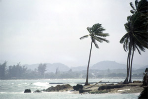 A cyclone is an intense vortex or whirl in the atmosphere with very strong winds circulating around in anti-clockwise direction in the northern and clock-wise in the southern hemisphere. The term Cyclone is derived from Greek 'Cyclos', meaning the coils of a serpent. Well this is how our knowledgeable ancestors described the vengeance of nature. They were perhaps able to observe that the whirlwind from the skies scooped on the sea, drawing columns of water and carrying the storm generated surge to the coast! The passing storm damaged dwellings and uprooted trees in its wake.
Coasts have a major role to play in a nation's economy. Apart from maritime trade most of the industries are located along our coasts. Some areas in the eastern coast are agriculturally rich too. A cyclone apart from the death and destruction causes a big dent in the economy.
Department of Meteorology has worked out a classification of low pressure systems in Bay of Bengal and in Arabian Sea . The classification has been adopted by the World Meteorological Organization:
in the Circulation
120 knots and above (222 kmph & above)
It is astonishing to note that out of 80 tropical cyclones that are born every year in the oceans globally 6.5% originate in the Bay of Bengal. Annually, on an average, about five to six cyclones originate in the Bay and in the Arabian Sea. O.P. Singh, and his colleagues T.M.A. Khan and Md. Sazedur Rahman of SAARC Meteorological Research Centre, Bangladesh carried out a research on past cyclones in Bangladesh and neighboring countries. They studied the data of 122 years (1877-1998) recorded history of all the tropical cyclones in the region. They found that the frequency of tropical cyclones in the north Indian Ocean has registered an increasing trend during the months of November and May. The intensification of rate of cyclonic disturbances to severe cyclones has shown an increase of 20% per 100 years during the month of November. They also observed that while the tropical cyclone frequency in this region is diminished considerably during June to September. The annual frequency of tropical cyclones in the north Indian Ocean has registered a decreasing trend of about 15% per hundred years. A statistical count of cyclones generated along the Indian coast and its surrounding areas on an average per year get 594 cyclones on the east coast compared to 172 on the west coast.
Storm surges are sometimes worst than the cyclone as the later comes and passes off, but the storm surges carry the sea water and dump it on the coast. They are generated by the winds and atmospheric pressure changes within the cyclones. In the low altitude land-locked areas like the Bay of Bengal the tropical cyclones are the major cause of storm surges. Increase in the Sea surface temperature (SST) causes greater convective activity, leading to an increased wind speed. Stronger winds and low pressures lead to stronger storm surges. Enhancement of SST in the Bay of Bengal therefore, could be as good as an open invitation for a tropical cyclone with strong storm surges.
The cyclonic storm is known as a hurricane in the Atlantic Ocean and a typhoon in the Pacific Ocean. These are frequently accompanied by exceptionally high rains 25-75 mm with strong winds and storm surges.
Storm surges in the past have caused havoc on both the coasts of India. Kolkata town was hit by storm 12m high surges killing nearly 300, 000 people. Again in 1864 storm surge of similar height struck Contai, near Digha coast in Orissa and killed 50, 000 people and 10, 000 heads of cattle.
How the storm surge causes a havoc is very clear from a recent report in the Science Daily quoting Yin Lu "Julie" Young, an assistant professor of civil and environmental engineering in Princeton University says, 'Storm surges result in very different mechanism. When it comes to forces on structure, what happens is very similar to what happens in a tsunami.' Civil engineering structures including buildings, resorts, dockyards etc are built to stand downward force of gravity. In the event of a storm surge the structure has to suddenly face an upwards and lateral push of water. This makes even the strongest structures weak.
Cyclone shows the power of the nature. It takes everyone by storm irrespective of cast, creed or culture. We have to learn to live with them and also develop techniques to minimize the damage.
Andhra Pradesh and Orissa are two states that are worst affected by cyclones. We read more about them in the coming issue.
29-Apr-2007
More by : V. K. Joshi (Bijji)
