Feb 22, 2026
Feb 22, 2026
 Tsunamis, earthquakes, landslides, rockslides etc are the nature's warnings to the mankind to beware and not to meddle with nature's balance. The trail of death and destruction left by the Indian Ocean tsunami was a warning that should not be ignored and forgotten like all other such disasters. More than 25% population of the country resides along the coasts and if we care for the precious lives then the disasters like a tsunami need a thorough preparedness. To be prepared, first the scientists have to work out why and how such a devastating tsunami occurred? What are the possibilities of a repetition of such an event is the next question that also needs to be answered.
This was an earthquake generated tsunami. What must have been the magnitude of the progenitor of this tsunami is a question that daunts the seismologists all over.
For developing countries of the world perhaps the beginning of the twenty-first Century was full of traumas in the form of natural disasters like earthquakes, tsunami, floods and cyclone. It was 26 December, 2003, when Bam in Iran was rocked by a severe earthquake, which buried hundreds alive. On the first anniversary of this notorious earthquake lives of several thousand people residing in the island countries of the Indian Ocean and eastern peninsular coast of India were cut short by a tsunami which was triggered by an earthquake of magnitude 9.2 along the Sumatra Subduction Zone in the Indian Ocean. The giant devastating tsunami is supposed to be the worst in the recorded history of the tsunamis in the living memory.
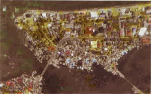
 Banda Aceh before Tsunami
|
The might of the progenitor earthquake of this tsunami can be understood from the fact that the sea floor was vertically displaced for six metres in a 1000 km long and 130 km wide ruptured segment along Sunda Trench, says Prabhas Pande Director Geoseismology, Geological Survey Of India, in one of his recent publications. This displacement pushed trillions of litres of water upwards generating ocean wide tsunamis, which were most lethal in the recorded history of tsunami disasters of the world. The force of the seismic shaking was such that 20% to 40% people on Banda Aceh, 65 km away from the epicenter were dead before the tsunami struck the Indonesian coast some 31 minutes later and plundered whatever was left remaining. |
Sub-marine disturbances like volcanic activity, landslides and earthquakes cause vigorous and powerful shaking of the sea column, which leads to tsunami. Out of these the earthquakes are responsible for causing maximum number of disastrous tsunamis. Such earthquakes of the off-shore are generally located in the subduction zone the continental plate is in the process of sliding beneath the other overriding plate. Earthquakes of the subduction zone are of four types in general: i) shallow interplate thrust events, where one plate rides over the other for a distance of more than two kilometers; ii) shallow earthquakes caused by the deformation with in the upper plate; iii) deep seated earthquakes of depths 40 to 700 km, where the oceanic slab is sucked in and iv) earthquakes that occur seaward of the trench.
A powerful earthquake of magnitude e" (Ergs) 7 may rupture a large segment of the subduction zone. In case of a thrust type earthquake the sea floor can be suddenly thrown up and produce a pedaling effect which can give rise to large sea waves or tsunamis.
The great Sumatra-Andaman earthquake of 2004 has been an eye-opener for the seismologists. This earthquake needs a rexamination of the commonly accepted views of the size of earthquakes and subduction zones, write the guest editors Susan L Bilek, Kenji Satake and Kerry Sleigh in the recent issue of the Bulletin of Seismological Society of America. Prior to 2004 earthquake the seismologists assumed that great earthquakes occurred only at the site of a young subduction zone, where one tectonic plate is quickly pushed underneath another one. With a moment magnitude of 9.1-9.3 the Sumatra-Andamans earthquake ranks third largest in the recorded history. This was an earthquake that gave the maximum insight to the seismologists to understand the nuances of what went at the abyss of the sea and how the plate ruptured. New technology as Geographical Positioning System and satellite telemetry came to the aid of the scientists for the first time. Field surveys helped in developing unique data sets to unfold the mysteries of such a large magnitude earthquake, an event that lasted for 600 seconds with a length of rupture between 1250 km to 600 km and not 1000 km as postulated by some workers (Pande). Stein and Okal, two of the renowned seismologists suggest that such devastating earthquakes occur after a long gap of 1000 years or so. Thus the correlation between rapid subduction and such types of earthquakes is not a tenable explanation. Rajendran, a seismologist from India observes that recurrence of earthquakes of magnitude >9.00 at the same spot are most unlikely. He also suggests a 1000 year gap between two such earthquakes at the same spot.
Well what happened in the past is based mainly on conjectures drawn from circumstantial evidences. But yes if present is a key to the past then certainly the last great earthquake was a storehouse of information for seismologists, planners and developers.
Tsunamis are devastating sea waves, yet different in the sense that they have larger wave lengths, greater amplitude, larger period and much greater velocity. A typical tsunami wave is about 10-20m high, with a wave length of 200km and a speed of 700 to 900 km ph in deep waters. It contains about one to ten percent of the total energy of the earthquake. Thus a tsunami that devastated a large chunk of our eastern peninsular coast and Andaman-Nicobar Islands had the energy equivalent to four million atom bombs detonating simultaneously. The threat of human generated bombs appears negligible compared to these Nature's explosives!
The tsunami waves approach the shore in a succession of crests and troughs. In case the trough portion of the wave reaches the shore first it draws down water and exposes the sea bed, like the phenomenon witnessed by some residents at Kanyakumari and Andamans. The sea water was turned greyish black said the locals. This was because the sea bed sediments were scooped out and churned with the incoming waves. The first two pulses were rather trough like and the sea looked like a just exposed land, but the third pulse was a real devastating one when waves hit back with a velocity of 8-10 metres per second.
The impact of tsunami can be different at different places. At places adjacent areas were spared by the wrath of the waves, but that does not mean that each time they will have the same escapade. The tsunami can change it's mood any time, depending on which part of the wave is going to strike a particular portion of the shore.
The Pacific Ocean is the home of most of the tsunamis. Tsunami Laboratory at Novosibirsk recorded a total of 796 tsunamis from 1900 to 2001, of which 117 were damaging and fatal type. 1938, as per the Laboratory data was a year of the tsunamis with 19 of them on record. However, luckily none of them caused any fatality or loss of property. In the Pacific region 17% of the tsunamis were generated in or near Japan. Amongst the world's tsunami South America accounts for 15%, Solomon Islands, New Guinea 13%, Indonesia 11%, Kuril Island and Kamchatka 10%, Mexico and Central America 10%, Philippines 9%, New Zealand and Tonga 7% and Hawaii 3% of the total tsunamis. In 1933 a Tsunami had stuck on 7th December had a run up of 30 m and killed 200 persons. Yet another tsunami at Awa, Japan in1703 killed more than one lakh people. Undersea volcanoes too generate tsunamis. One such underwater explosion at Krakatua Island on 26-27 August, 1883 caused waves as high as 35 m in several areas of East Indies and took a toll of more than 36, 000 human lives.
Records of 16 Tsunamis are available from Indian Ocean since 1762. But the mother of all, the December 2004 Tsunami affected Indonesia, Sri Lanka, India, Thailand, Malaysia, Maldives, Myanmar, Bangladesh, Somalia, Tanzania, Seychelles and Kenya. The effect of the Tsunami was also felt in Madagascar, Mauritius, Mozambique, South Africa, Australia, Antarctica, New Zealand and coasts of South and North America.
The progenitor of the Indian Ocean Tsunami, the massive Sumatra earthquake had its side effects felt at far off places. Almost all civil structures in Andaman Islands suffered varying degrees of damages including total collapse in some cases. Eruption of some mud-volcanoes, reactivation of faults, subsidence and uplifting of land surface, changes in bathymetric profiles and large fluctuations in groundwater were additional impacts of this earthquake.
Seismologists are debating over the issue of Early Warning System for Indian Ocean Tsunami of the magnitude that occurred in 2004. Utility of such a system can not be denied. In Kenya, the radio and the television warned the people three hours in advance about the possible tsunami reaching the coasts on 26 December, 2004. Result was that only one life was lost. Whereas, in Somalia no such warning was issued and 300 lives were lost just eight hours after the earthquake.
The system that is being installed is similar to the one that protects the earthquake prone Pacific rim or the 'Ring of Fire'. The system will cost around $30-50 million. All countries bordering the Indian Ocean will have to develop a National Tsunami warning centre to take advantage of the system.
Roger Bilham an eminent seismologist from University of Colorado has other ideas. He says that Indian Ocean Tsunamis are quite infrequent and there are methods to get forewarned about the event and the information can be effectively disseminated without incurring such a heavy expenditure.
The 26 December, 2004 Tsunami has almost conveyed the Ocean's warning, 'beware, coasts are my territory, don't trespass'. Do we care? We are still blatantly encroaching the coasts and preparing for a still greater death and devastation drama in the future.
10-Mar-2007
More by : V. K. Joshi (Bijji)