Sep 26, 2026
Sep 26, 2026
by Sahithi B
How EOS-05 Is Changing Earth Observation
“Technology is not an objective to be aimed at, but a tool to be used for the benefit of the common man.”
— Dr. Vikram Sarabhai
On a clear night, we look up and see stars, planets and satellites moving silently overhead. Some of those satellites, however, are doing more than passing by. They are watching Earth.
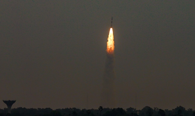
On September 4, 2026, the Indian Space Research Organisation (ISRO) launched EOS-05, an advanced Earth-observation satellite, aboard the GSLV-F17 rocket from the Satish Dhawan Space Centre in Sriharikota. ISRO describes it as India's first imaging satellite designed to operate from geosynchronous orbit, and that single detail is what makes the mission so interesting. EOS-05 is not just another satellite taking pictures. It is built to observe large areas again and again, giving India a more continuous view of a planet that never stops changing.
The Launch: A Step-by-Step Climb
GSLV-F17, the 19th flight of India's Geosynchronous Satellite Launch Vehicle, lifted off from the Second Launch Pad at Sriharikota at 2:55 AM IST. Rather than placing EOS-05 directly into its final orbit, the rocket released it into a Sub-Geosynchronous Transfer Orbit (Sub-GTO). From there, the satellite used its own liquid apogee motor to climb the rest of the way:
The satellite was targeted for the 85.5° East orbital slot, roughly 36,000 km above Earth. Reaching that height is not a matter of simply launching upward; it takes a carefully planned sequence of manoeuvres.
Why the Orbit Matters
Most Earth-observation satellites fly in low orbits, circling the planet quickly and capturing images of each location only as they pass over it. EOS-05 works differently. In geosynchronous orbit, its orbital period matches Earth's rotation, so it stays above broadly the same region while the planet turns beneath it.
Think of two photographers covering a city. The first keeps travelling around it, taking a snapshot of each neighbourhood whenever they pass through. The second stands on a high tower and keeps watching the whole city at once. Low-orbit satellites are the first photographer; EOS-05 is the second.
This raises an obvious question: wouldn't a closer satellite take better pictures? Often, yes. Being nearer to Earth helps capture fine spatial detail, which is why most imaging satellites stay low. But Earth observation is not only about resolution. It is also about how often you can look, how much area you can cover and how quickly you can spot change. EOS-05 trades some detail for frequency and coverage. It is not meant to replace India's existing Earth-observation fleet but to add a capability that fleet lacks.
An Eye That Keeps Watching
According to recent reporting on the mission, EOS-05 is planned to observe broad areas of the Indian subcontinent roughly every 30 minutes, with selected areas potentially revisited as often as every five minutes.
Why does that matter? Imagine photographing a moving car once every few hours. You would know where it was at each moment, but not how it got there. Photograph it every few minutes, and you begin to understand its movement. Earth works the same way. Cyclones move, floods spread, forest fires grow, clouds shift and crops develop. The more often a satellite sees a region, the better scientists and authorities can follow these changes as they happen.
From Orbit to the Ground: What EOS-05 Can Do
“Dream transforms into thoughts. Thoughts result into actions.”
— Dr. A. P. J. Abdul Kalam
The value of EOS-05 lies in how its observations turn into action on the ground. Three areas stand out.
Disasters. Picture a cyclone forming over the Bay of Bengal. Conditions change by the hour, and disasters do not wait for a satellite's scheduled pass. Repeated observations from a fixed vantage point can give disaster-response teams a far more continuous picture of cyclones, floods and forest fires.
Agriculture. From orbit, satellites can track vegetation and land conditions across vast farming regions. Frequent imaging could help agencies monitor crop health, study vegetation changes and assess damage after extreme weather, offering a scale that ground surveys alone cannot match.
Natural resources. India's forests, rivers, wetlands and coastlines are too extensive to monitor from the ground alone. EOS-05 can help build a more detailed, up-to-date picture of how these resources change over time.
This is the very purpose Sarabhai envisioned for India's space programme: using space technology to solve practical problems such as resource management and communication.
Where Computer Science Meets Space
A satellite can collect enormous volumes of data, but collecting it is only half the job. Making sense of it is the real challenge, and that is where artificial intelligence, machine learning, computer vision, data science, geographic information systems and cloud computing come in.
An AI system could scan thousands of images to identify where floodwaters have spread, flag unusual changes in vegetation or compare the same region across days and seasons. The satellite provides the eyes; computer science turns what it sees into intelligence. For students in CSE, AI, cybersecurity or data science, space technology is fast becoming one of the most exciting fields to explore.
The Bigger Picture
EOS-05 is not an isolated achievement. India's space programme has grown from early experimental applications into sophisticated systems for communication, navigation, meteorology, remote sensing and scientific exploration, guided by ISRO's stated aim of applying space technology to national needs.
Looking ahead, future systems may combine more advanced satellites with artificial intelligence, big-data analytics and real-time monitoring. The future of Earth observation may be less about taking better pictures and more about turning satellite data into faster, smarter decisions.
And the people who benefit most may never see the satellite at all. A farmer does not need to know it is overhead. A disaster-response worker does not need to understand orbital mechanics. The value appears when information gathered 36,000 kilometres above Earth becomes useful on the ground.
Conclusion: India's Eye on a Changing Earth
Launched on September 4, 2026, and raised to a near-circular orbit about 36,000 km above Earth, EOS-05 marks a new chapter in India's Earth-observation capabilities. Its real significance lies not in its altitude but in what that altitude allows it to do: keep watching, keep observing and help us understand a planet in constant motion, from cyclones over the ocean to crops across India's farmland.
“Space technology has the potential to address the real problems of man and society.”
— Dr. Vikram Sarabhai
Perhaps that is the most powerful idea behind EOS-05: the farther we look from Earth, the better we may understand the world beneath us.
Image (c) istock.com
26-Sep-2026
More by : Sahithi B