Jul 08, 2026
Jul 08, 2026
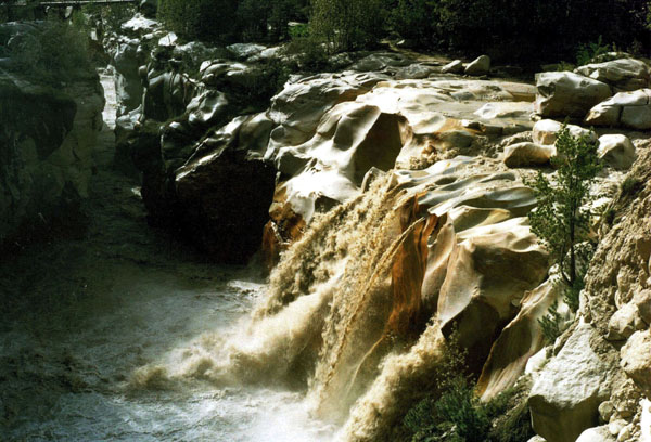
Our trek to Tapovan starts from Gangotri (3048m). Gangotri is 281 km from Haridwar. Gangotri is the terminus of National Highway 108. We start from Haridwar by jeep early in the morning and halt at Uttarkashi (1158m), 174 km from Haridwar. After spending a night at Uttarkashi we reach Gangotri next morning (107 km). There are many hotels to stay. We spend the day acclimatizing and visiting the temples and Suryakunda. This is the picture of Suryakunda in Gangotri. The Ganga falls from a height of about 60 feet to meet the Kedar Ganga coming from Kedar Tal. Kedar Tal is another arduous trek from Gangotri.
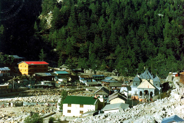 Our trek begins with a steep ascent. This is the Gangotri town, as seen from a point of rest. To the right is the Gangotri temple made of granite rock. A Gorkha Commander, Amar Singh Thapa constructed it in the early 18th century. Later the Maharaja of Jaipur rebuilt it. The temple is dedicated to the Goddess Ganga. It is said that some hundreds years back, the source of Ganga was in Gangotri.
 Our trail goes along the left bank of the Ganga. Three unknown peaks on the other side of the Ganga on our right side. They keep a benign watch over us for quite sometime, before hiding their face.
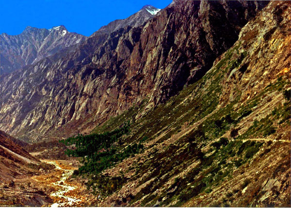
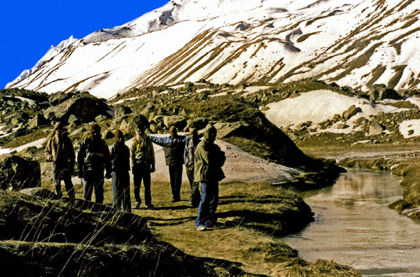
The greenery thins out within the first few kilometers. The trekking route is not that arduous. It is one of gentle ascent. However, the route is often perilously narrow. As we near Chirbasa, the greenery reappears. We take occasional rest at the Chottis to have tea and snacks, and gossip with local people.
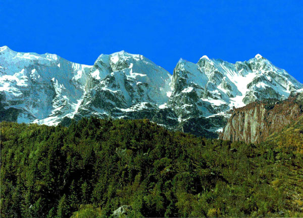
 Snow-capped peaks are our constant companion.
We have reached Chirbasa, a trek of 9 km from Gangotri. The mighty Bhagirathi group of peaks can be seen at the backdrop.
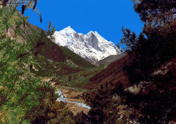
As we move ahead beyond Chirbasa the terrain becomes really desolate.
We have another 5 km to walk to reach Bhojbasa. New peaks play hide and seek with us. This is the advantage of visiting this area in October. Given a bit of luck, the peaks are visible all day long.
Looking back. The string on the slope of the mountain is our track. The other string down there on the left is the young Ganga.
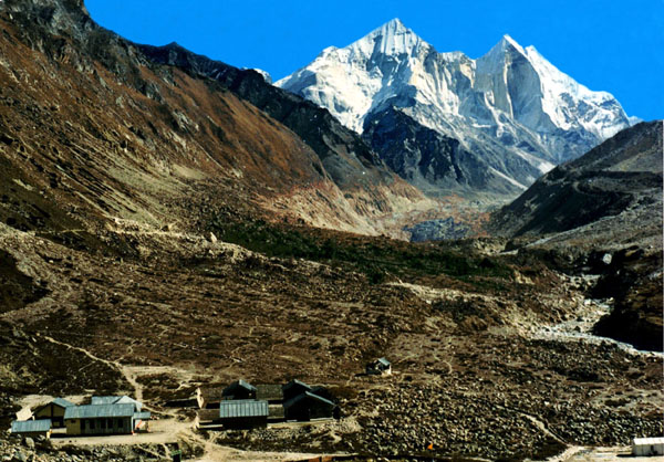
Bhojbasa valley with the majestic Bhagirathi group of peaks (They are called Bhagirathi-I, II, III) in the background. On the left corner is the GMVN Bungalow. The Gaumukh, source of the Ganga, can be seen at the foot of the Bhagirathi peaks. It is 4 km from here. There is a picturesque campsite beside the river. Image on the right is the Bhojbasa valley.
As the sun slopes towards the west, the shadow of the mountains lengthens.
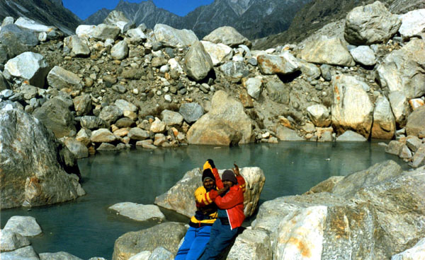 We spend the night at Bhojbasa at a ‘Choti’. Next morning we start our trek to Tapovan via Gaumukh. En route our trek from Bhojbasa to Gaumukh, this water body gives us much joy. It is completely frozen as can be seen from the pieces of rocks ‘floating’ on it. Of course, it is all our experimentation to check the quality of the ice. We are just hundred meters from Gaumukh.
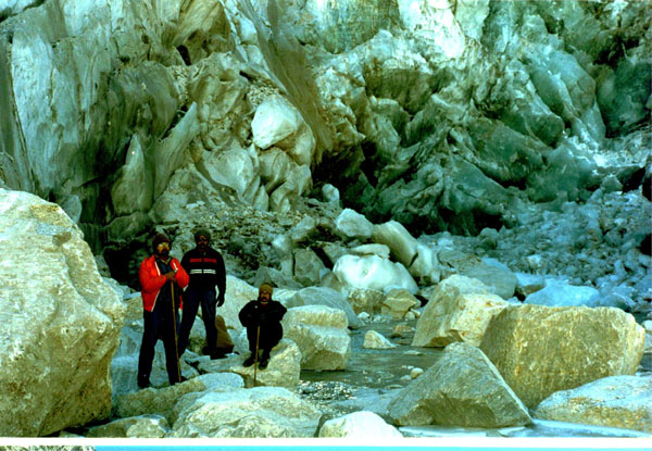
This is Gaumukh. Unfortunately, it no longer looks like Gaumukh – ‘a cow’s face’. Massive ice chunks lie scattered. The snout and the adjacent area of the glacier often crack. It is better not to go too close to the snout.
Our trek to Tapovan begins. We have to trek or rather climb over the snout. From Gaumukh to Tapovan the ascent is steep. En route Tapovan Slowly we make our way up negotiating boulders and crevasses. This portion of our trek is the most perilous one. No one knows where crevasses lurk. Guides know the safer route.
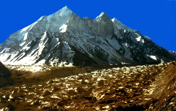
A view of the entire Gangotri glacier below, as we climb the steep ascent along Akash-Ganga falling from Tapovan valley. The Gangotri glacier is at present 26 km long. Global warming is eating away at least 100 m of the glacier per year!
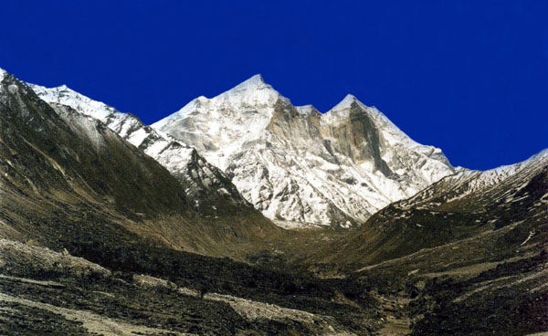
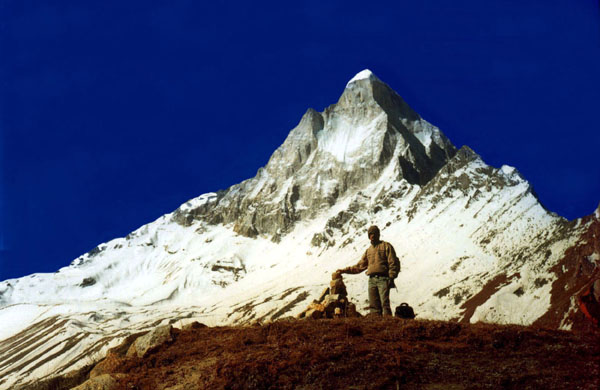
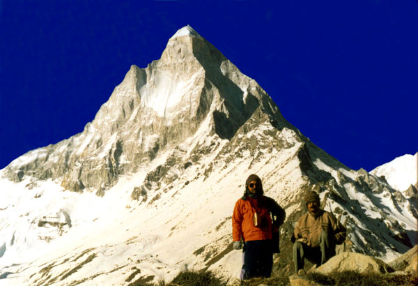
From Gaumukh we trek 4km (2-3 hrs) up and across the Gangotri Glacier climbing over boulders, with a final ascent up a 300m vertical wall along the celestial Akash-Ganga. We have reached Tapovan. This shot is taken from the edge of Tapovan valley. (4,463m/14,683ft) Tapovan is a vast meadow of golden grass and is surrounded by peaks. Mt. Shivling (6543m) flanked by Mt. Meru (6630m) and Kedar Dome (6808m), Sudarshan (6,507m). on the other side of the glacier are the Bhagirathi group of peaks - 1 (6,856m), 2 (6,512m) and 3 (6,454m).
We spend the night at a cave adjacent to Mauni Baba’s tent. He makes Khichudi for us. We cannot sleep at night. It is freezing cold. As the chilling wind blows, strange sounds can be heard throughout the night.
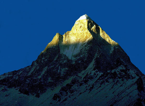
Next morning as we come out of the cave, we see the first rays of sunlight kissing the Shivalinga. We are now in heaven.
My cousin brother Nibir stands at the highest point of Tapovan.
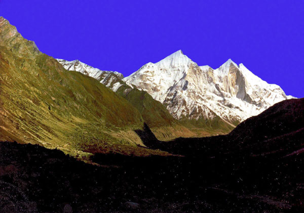
Tapovan valley. The myth has it that King Bhagiratha (Lord Rama’s ancestor) of the Ikshvaku dynasty, meditated here to Shiva for Ganga’s descent to the earth. There are ideal spots for camping. The upper Tapovan valley is known as Gandharvavan.
Akashganga. It comes down giggling from the Shivalinga. The myth goes that this is the original Ganga coming down from Lord Shiva’s ‘Jata.’
Another view of Shivalinga. We are now ready to bid the valley good bye and return to Bhojbasa. The trek to Tapovan combines the experience of mountain climbing, rock climbing, boulder-hopping and glacier traversing all in one. We will certainly come back again.
06-May-2007
More by : Indrajit Bandyopadhyay
|
|
Excellent travelogue and beautiful photography. Thanks |
|
|
Beautiful article and absolutely beautiful pictures. We are attempting this trek towards the end of this month. Thank you for sharing your experience. Hope the global warming has not depleted this place's beauty in these 8 / 9 years. |
|
|
Loved the article and the pictures. I lived every moment of the trek that I had undertaken almost 2 decades back. Looks like nothing much has changed and I am happy to see that. Bjojwasa still has very few options to stay. I hope the cleanliness is being maintained to keep the purity of this beautiful place alive. Thanks Indrajit for this article :) Hope trek from Gaumukh to Tapovan is not so difficult?? |
|
|
I will surelly go here...someday.. |
|
|
Great Trip boss..soon I will share my experience here. |
|
|
the pictures shows that what is a real heaven. i want to reach there |
|
|
fabulus pic pic. we r unlucky we returned from the gomukh. becausse we didn,t have guide but next time we will definetly go to tapovan |
|
|
very nice pictures |
|
|
thirlled --- u are blessed |
|
|
Good pictures and brief but to the point description of the holy trek route/ |
|
|
fantastic pictures and nice narration of the trek/tour..:-) |
