Jul 25, 2026
Jul 25, 2026
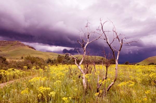
In the Tropics extreme climatic vicissitudes are common and mostly of convective nature. Large tracts of eastern India, i.e. Gangetic West Bengal, Jharkhand, Orissa, Bihar, Assam and parts of some northeastern states are hit by sudden convective storms accompanied by rain, thunder and lightening. These storms are initiated during the months which precede the monsoon; that is from April to June every year.
As per the Hindu calendar 14th April or the first day of the month of Baishakh heralds the New Year, affectionately called 'Pohela Boisakh' by the Bengali community. Being the New Year's Day, it is naturally a day of rejoicing and reverence.
Usually the heat in the month of April is unbearable, especially in urban Kolkata. While working in the basement of India Museum way back in 1974, this author has actually experienced the trauma of the humid heat. Sweat pouring out from all the pores of the body and the clothes are soiled, one has no option but just to pray for relief . The rickety table fan of the Museum was making more noise than providing me any relief from the heat, till the caretaker advised me to take off my shirt. It was better, yet unforgettable experience. And on one such sweltering day suddenly clouds loomed from no where, the sky turned extremely dark and within no time it started to pour with howling winds that seem to surround me in a whirlpool. For some time the intense heat was forgotten.
The experience of this relief often takes its toll in the form of tragedies. Falling trees, flying tin sheets, take people in the open, unawares. Farmers are affected as the sudden squall ruins their crops. 'The casualties reported due to lightening associated with thunderstorms in this region are the highest in the world and highest number of aviation hazards are reported during the occurrence of thunderstorms', say A.J. Litta and U.C. Mohanty of IIT Delhi. Since the storms are initiated in the month of Baishakh, they are termed as 'Kal-baishakhi' or 'Nor'westers'. These storms have a great socio-economic significance. They are a hazard responsible for nearly 72% tornadoes in this region.
The science of meteorology has advanced in leaps and bounds globally. India is trying to catch up fast too. There is an all round attempt to 'sniff' the 'Kal-baishakhi' before it hits the common man. Forecasting thunderstorms is quite tricky because of their small signatures in time and space and their complex dynamics and physics.
Computers have made the life of weather forecasters easier. They often rely on massive computer programmes called numerical weather prediction models. These models based on several parameters and complex mathematical formulae help the forecasters to find out 'when' and 'where' of a storm. These models called as weather prediction models are designed to calculate what the atmosphere will do at certain points over large area, from the Earth's surface to the top of the atmosphere. The weathermen, like the detectives keep observing and noting 'what the weather is doing now', in the hope of finding clues for the future. Data collected with the help of balloons launched around the globe twice a day, measurement from satellites, aircraft and temperature profilers and the surface weather stations all pool in data to form reference grid points for the modelers. More the number of grid points more precise is the prediction model.
'Nor'westers' affect parts of a large region. They appear all of a sudden and after inflicting the damage, vanish like a ghost. Though it is impossible to save the agriculture but at least lots of lives and properties can be saved if the storms can be predicted with precision. Realizing the significance, the Department of Science and Technology, Government of India, launched an ambitious project Severe Thunderstorm Observation and regional Modeling (STORM) to understand the genesis, development and propagation of severe thunderstorms over eastern and north-eastern India. Such a study would also enhance the knowledge of dynamical and thermo-dynamical role of micro-physical processes on intensification of these severe storms; help in understanding the atmospheric electrification during the storms and their interaction with cloud micro-physical process. These would lead to development/customization of meso-scale prediction system which would give precise and timely forecasts.
The project led by Mohanty involved a large number of department and resources to acquire the much needed data. Litta and Mohanty carried out the simulation of thunderstorms and achieved quite a precision. The 'grid box' conceived in the atmosphere by the mathematical climate modelers has sides as high as 100 to 300 km. To use it to forecast storms generated by cumulus clouds at a maximum height of one km is a problem. The problem has been resolved by the meteorologists by developing meso-scale models with facility of altering horizontal and vertical resolutions, nesting domains and choosing appropriate options for physical parameterization schemes. Severe weather disturbances like tornadoes, hail and squall line are of convective nature.
Litta and Mohanty used a non-hydrostatic meso-scale model (NMM). This model forms the core of Weather Research Forecasting (WRF) system of USA. Since the model envisages to study and analyze storms originating at mush less heights than the standard models, for simulation of such storms cumulus or convective parameterization (CPP) schemes are used. These schemes use complex mathematical formulae and computer programmes. Climatologists all over the globe are working on the problem of weather forecasting and specially events like 'Nor'westers', various schemes are available for running pilot projects. Some of them like Anthes-Kuo, Betts-Miller, Grell-Devenyi and Kain Fitsch schemes were used by Litta and Mohanty. From the names of the schemes it is imperative that they are named after the scientists who worked on them.
After applying the CPPs, they found that Grell-Devenyi scheme gave the best results. Georg A. Grell and Dezso Devenyi, climatologists working on mathematical modeling at the University of Colorado, USA published their scheme in the Geophysical Research Letter, Vol. 29 (2002).
Global scientific community exchanges data or projects their data which includes information on the time of occurrence of a storm or time forecasted for an occurrence. Therefore, instead of using the country's standard time or GMT, they make use of coordinated Universal Time or UTC. In their study, the IIT team initiated the model at 0000 UTC of 20 May 2006 and ran it for 24 hours. Using the same parameters they simulated the thunderstorm for 36 hrs from 0000 UTC of 19 May 2006 and for 48 hours from 0000 UTC of 20 May 2006.
The outcome of the study was a precise forecast based on simulation 24 hours before the onset of 'Kal-baishakhi' on 20 May. They found that the model needed further refinement for a better forecast 36 or 48 hours before the onset of the storm.
Since the project STORM will continue till 2010 the team leader Prof U.C. Mohanty is quite optimistic of refining his results and be able o give precise forecasts of Kal-baishakhis well in time.
Prediction and forewarning the population about the natural hazards well in time is becoming more and more significant each day. The population pressure is such that in the eventuality of being caught unaware the loss of life becomes more. A forewarned population can therefore hope to avoid the loss of life. However, the loss of agriculture or even property at times is inevitable.
12-Sep-2008
More by : V. K. Joshi (Bijji)
